Image source: Magnefic
Introduction
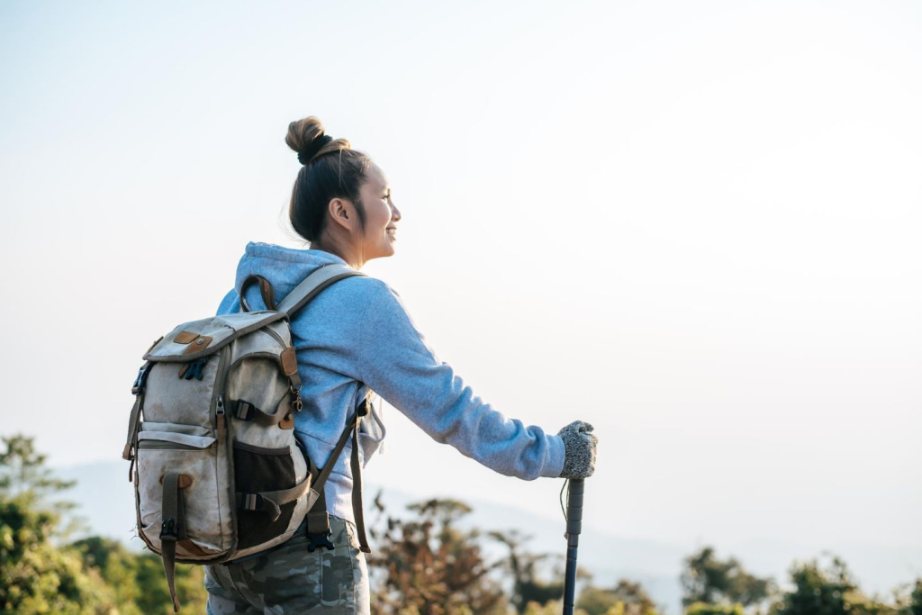
Every summer, more Filipinos leave the city behind in search of cooler weather, open landscapes, and physically rewarding outdoor trips. Hiking has become one of the most popular alternatives to traditional beach vacations, especially among travelers from Metro Manila looking for a different kind of break.
The appeal of mountains to hike in summer now extends far beyond local weekend climbs. Some hikers prefer short trails close to home, while others plan multi-day trekking journeys across Europe, Peru, Nepal, or New Zealand. Each destination offers different scenery, terrain, weather conditions, and levels of difficulty.
Why Summer Changes the Hiking Experience
Dry-season conditions make many hiking trails safer and easier to access compared to the rainy months. In the Philippines, summer often means clearer summit visibility, more stable walking conditions, and fewer weather disruptions along exposed mountain routes.
Internationally, the season also opens famous trekking paths that remain inaccessible during winter and spring. Trails across the Alps, including the Tour du Mont Blanc, become active once snow begins to melt. Mountain huts reopen, alpine meadows emerge, and high passes become safer for long-distance hikers.
The Planning Challenges That Come With Peak Hiking Season
Still, summer hiking requires careful planning. Crowds increase across popular mountains, temperatures rise sharply on exposed volcanoes, and permits inside protected national park areas can sell out quickly. Most people also underestimate how quickly conditions can change once a climb begins.
A trail that feels manageable near the trailhead can become far more demanding after several hours of exposure, especially during summer afternoons when heat and fatigue start to affect pacing. Whether someone plans a short overnight hike or a multi-week trip abroad, preparation remains part of the experience itself.
Image source: By Bien02 – Own work, CC BY 4.0, https://commons.wikimedia.org/w/index.php?curid=149887087
Mt. Pulag National Park, Benguet
Mount Pulag remains one of the most recognizable mountains in the country because of its sea of clouds and relatively accessible summit route. Located in northern Luzon, the mountain sits inside a protected national park and reaches about 2,900 meters above sea level, making it Luzon’s highest point.
The Appeal of Sunrise Climbs Above the Clouds
Most hikers choose the Ambangeg trail because it offers a shorter and less technical climb. The Akiki route, meanwhile, attracts more experienced hikers looking for steeper terrain and longer walking hours. Summer conditions make the climb easier compared to the rainy season, though temperatures near the summit can still drop sharply before sunrise.
Managing Crowds Along the Summit Route
The mountain’s scenery changes across different sections of the trail. Mossy forests eventually open into dwarf bamboo fields before the summit ridge appears above the clouds. Many hikers begin their summit assault around midnight to catch sunrise conditions at the peak. During peak season, hikers sometimes spend the same amount of time waiting along narrow summit paths as they do actually walking toward the top. Arriving earlier in the night often becomes a better way to avoid bottlenecks before sunrise crowds fully build up.
Visitor management has become stricter over the years. DENR registration, orientation sessions, medical certificates, and local guides are now standard requirements for entry into the protected landscape.
Image source: https://commons.wikimedia.org/wiki/File:Tuktok_ng_Pilipinas.jpg#/media/File:Tuktok_ng_Pilipinas.jpg
Mt. Apo, Davao Region
Mount Apo offers a completely different experience from many Luzon climbs. As the highest point in the country, Mt. Apo combines volcanic landscapes, forest trails, river crossings, and rocky summit sections that require greater endurance.
Why Mt. Apo Feels More Demanding Than Most Philippine Climbs
Unlike beginner-friendly hiking trails near Metro Manila, this climb usually takes several days. Hikers pass through dense forests before reaching open grasslands and sulfur vents closer to the summit.
Lake Venado often serves as a major camping and rest area before the final ascent. The changing terrain also makes the route feel longer and more physically demanding than many first-time hikers expect.
Weather conditions remain unpredictable even during summer. Strong wind exposure near the upper slopes can quickly lower temperatures after sunset. Many hikers underestimate the physical demand because of the mountain’s popularity online, but the climb remains one of the country’s more demanding trekking experiences.
Respecting Indigenous Territory Around Mt. Apo
The mountain also sits within ancestral territory connected to Indigenous communities in Mindanao. Responsible climbing practices and proper coordination with local authorities remain important parts of the experience.
For families based in southern Metro Manila, communities such as Camella Muntinlupa provide easier access to major expressways leading toward airports and provincial transport hubs, making domestic outdoor adventures more manageable even during busy travel weeks.
Mt. Pinatubo, Zambales and Tarlac
Mount Pinatubo became one of the Philippines’ most unusual hiking destinations after its massive eruption in 1991 permanently transformed the surrounding landscapes. Today, the route combines off-road travel and walking across lahar fields before reaching the crater lake.
Unlike forest-heavy climbs, this mountain exposes hikers to direct sunlight for most of the hike. Summer temperatures can become intense within an hour after sunrise, making early departures essential. The route itself is relatively manageable, though loose volcanic terrain can still slow down inexperienced hikers.
The scenery feels dramatically different from traditional Philippine mountains. Instead of mossy forests and lush valleys, hikers encounter ash canyons, dry riverbeds, and volcanic rock formations shaped by previous eruptions. The mountain demonstrates how volcanoes can reshape entire ecosystems while eventually becoming major travel destinations again.
Tour du Mont Blanc, France, Italy, and Switzerland
The Tour du Mont Blanc remains one of the world’s most famous long-distance trekking routes. The trail circles the Mont Blanc massif through France, Italy, and Switzerland, crossing different sections of the Alps over roughly 10 to 11 days.
Unlike short summit climbs common in the Philippines, the Tour du Mont Blanc focuses on endurance and sustained elevation gain across multiple days. Hikers move between villages, mountain huts, and alpine meadows while crossing major passes with views of glaciers and snow-capped peaks.
The Physical Demands of Crossing the Alps on Foot
The route is physically demanding even without technical climbing skills. Fast-moving clouds, rain, and cold wind systems are common even during summer in Europe. The full course of the trek also requires careful logistical planning because weather systems across the Alps can shift rapidly within a single day. Hikers who rush through the route often miss smaller villages, quieter alpine scenery, and rest stops that make the journey feel less mechanical and more immersive.
How Infrastructure Shapes the Trekking Experience in Europe
One reason the trail became so influential is its infrastructure. The du Mont Blanc network includes marked paths, mountain refuges, transportation access, and an established trekking culture built over decades. Most visitors do not complete the full route and instead choose shorter variations depending on fitness level and available time.
The experience also highlights how hiking culture differs internationally. In many parts of Europe, long-distance walking routes connect directly to towns and villages, allowing hikers to spend the night indoors instead of relying entirely on camping systems.
Annapurna Circuit, Nepal
Annapurna Circuit represents one of the most iconic high-altitude trekking routes in the world. The trail crosses remote Himalayan villages, steep mountain passes, and valleys surrounded by some of the tallest peaks on Earth.
Why Altitude Changes the Entire Trekking Experience
The route differs from shorter hiking trails because altitude becomes one of the biggest challenges. Even strong hikers can struggle once oxygen levels decrease significantly. Acclimatization days are essential throughout the journey, especially before crossing Thorong La Pass.
The scenery constantly changes across the route. Lower elevations contain forests and agricultural settlements, while upper regions transition into dry alpine terrain surrounded by glaciers and snow-capped peaks. Some hikers spend more than two weeks completing the full circuit.
Unlike many climbs in Southeast Asia, the Annapurna Circuit depends heavily on tea house systems rather than traditional camping. Meals, lodging, and recovery stops become critical parts of the trekking experience because hikers spend extended periods in isolated mountain territory.
Machu Picchu, Peru
Machu Picchu combines mountain trekking with archaeology and cultural history. Rather than focusing purely on reaching a summit, the experience centers on following ancient Inca paths through cloud forests and mountain passes before arriving at the ruins themselves.
Walking Ancient Inca Routes Through the Andes
Strict visitor regulations now control access to the Inca Trail because of growing crowds and environmental pressure. Permits often sell out months ahead of time during peak season. Most hikers spend several days walking through campsites and high-altitude terrain before reaching the ancient ruins at sunrise.
The route’s popularity comes partly from the balance between natural scenery and historical significance. Hikers move through landscapes filled with steep cliffs, dense vegetation, and ancient stone structures that reveal the region’s rich history. Few mountain destinations combine physical exertion and archaeological importance as successfully as Machu Picchu.
Atlas Mountains, Morocco
The Atlas Mountains offer a very different type of summer hiking environment compared to tropical or alpine regions. Located across North Africa, the Atlas Mountains contain dry valleys, rocky passes, and villages connected through old caravan routes.
Summer temperatures can become extreme at lower elevations, but higher mountain sections provide cooler conditions suitable for trekking. The terrain lacks the dense greenery many Filipino hikers associate with mountain travel. Instead, the route features exposed cliffs, desert-facing slopes, and isolated settlements with deep cultural traditions.
The region’s appeal also comes from its human geography. Hiking through Berber communities gives travelers opportunities to explore landscapes shaped by centuries of trade and migration. Unlike the crowded tourism systems found in some parts of Europe, many Atlas Mountains routes still feel quieter and less commercialized.
Aoraki / Mount Cook National Park, New Zealand
Aoraki / Mount Cook National Park showcases some of the most dramatic mountain scenery in the Southern Hemisphere. Located in New Zealand’s South Island, the park contains glaciers, alpine lakes, waterfalls, and steep peaks shaped by centuries of ice movement.
Because New Zealand seasons operate opposite to those in the Philippines, many travelers visit during the Philippine holiday break. Summer conditions there often align with cooler weather compared to Southeast Asia.
Why New Zealand Appeals to Both Casual and Experienced Hikers
The country’s trail systems are highly organized. Clear signage, regulated campsites, and maintained walking paths make the destination appealing even for less experienced hikers. At the same time, weather systems remain unpredictable. Strong winds, sudden rain, and rapid temperature drops can affect visibility within a short period.
The combination of coast drives, national park routes, and mountain scenery also makes New Zealand attractive for travelers who want both hiking and road trip experiences within the same journey.
Glacier National Park, Montana, USA
Glacier National Park represents a classic North American wilderness hiking destination. Located in Montana near the Canadian border, the park contains alpine lakes, forests, glaciers, waterfalls, and extensive backcountry trail systems.
Hiking Through Remote Wilderness in Montana
Summer becomes the primary hiking season because snow blocks many higher routes during spring and fall. Some trail systems only open fully for a limited number of months each year. Wildlife awareness is also a major part of the experience since hikers regularly enter bear territory.
Compared to more crowded routes in Europe, parts of Montana still feel remote and isolated. Long stretches of trail may contain few visitors, especially outside major tourist corridors. Camping permits and route planning become important because emergency access in wilderness areas can be limited.
A Different Style of Mountain Travel in North America
For many hikers, Glacier National Park represents a different philosophy of outdoor travel. Instead of moving between villages and mountain huts, the experience emphasizes self-sufficiency, solitude, and immersion in large natural landscapes.
Conclusion
From the volcanic trails of the Philippines to the glaciers of New Zealand and the high passes of the Annapurna Circuit, mountain travel continues to attract hikers looking for experiences that feel more immersive than ordinary vacations.
The best mountain trips usually come from good planning, realistic pacing, and respect for the landscapes being explored. No matter the destination, every trail offers a different way to experience nature, movement, and the world beyond the city.


